• Garmin
• Albuquerque (International Sunport) Airport
• Hayden (Yampa Valley) Airport
• Cabo San Lucas International Airport
BAN's World Gazetteer
• Kansas The bimonthly news publication for aviation professionals.
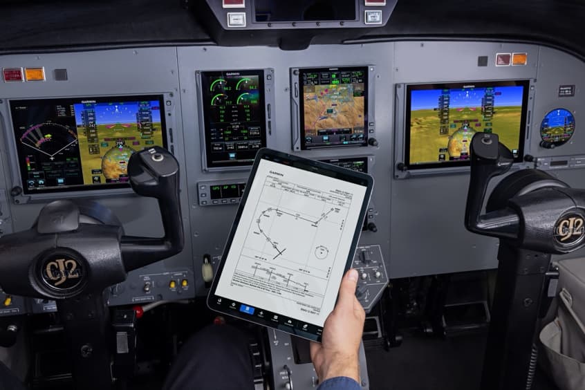
Garmin is introducing additional runways and airports for Guided Visual Approaches, including multiple runways and airports in Mexico. This growing database provides lateral and vertical guidance for pilots flying visual approaches into challenging airports. Designed in collaboration with Hughes Aerospace, this latest update adds 12 new Guided Visual Approaches and eight new airports, including Albuquerque International Sunport in New Mexico, Yampa Valley Regional airport in Hayden, Colorado and Cabo San Lucas International airport. These new Guided Visuals are now available through flyGarmin.com, bringing the database total to 77 visual approaches in 56 challenging airport environments.
Pilots using Guided Visuals will experience a similar look and feel as traditional approaches from the time they load them into the avionics all the way to flying them to the runway. Lateral and vertical guidance is provided, and the visual approaches can be flown coupled to the autopilot, allowing pilots to focus their attention outside the aircraft. Additionally, all Guided Visual Approaches have a georeferenced approach chart available, making briefing and flying these procedures a familiar experience for pilots. All charts can be accessed like traditional Garmin FliteCharts on applicable avionics.
Guided Visuals can enable pilots to fly more stabilised visual approaches, especially in faster aircraft or when flying into airports in areas of higher terrain and obstacles. Guided Visuals also aid pilots flying visual approaches into airports surrounded by cityscapes and lights at night, making it easier to stay in visual contact with the runway.
Guided Visuals are compatible with Garmin WAAS-equipped avionics capable of RF legs, such as the GTN and GTN Xi series navigators, and select Garmin integrated flight decks. Aircraft owners and operators should reference their pilot operating handbook or aircraft flight manual to determine operational capability of required navigation performance procedures with radius-to-fix legs.
Pilots who use Garmin Pilot on Apple mobile devices have the option to view Guided Visual FliteCharts in the Garmin Pilot mobile app. Guided Visual procedures in Garmin Pilot provide easy access and briefing of these charts. Additionally, Guided Visuals are available to load as an approach procedure in the flight plan to view the procedure atop the map, like other approach types.
Guided Visuals can be purchased on flyGarmin.com like other Garmin database offerings. Customers may choose from several database options that include Guided Visuals, including a OnePak offering comprehensive data coverage for their Garmin avionics.