ACE 2026 - September 8th
• Garmin
• Long Beach (Daugherty Field) Airport
• San Jose International Airport
BAN's World Gazetteer
• Kansas The bimonthly news publication for aviation professionals.
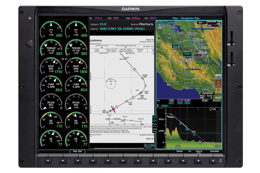
Garmin has expanded the coverage of its Guided Visual Approaches database, adding 15 more procedures and 10 additional airports aimed at supporting pilots flying visual approaches into demanding locations.
The latest update includes airports such as Long Beach Airport (KLGB) and Norman Y. Mineta San Jose International Airport (KSJC) in California. The procedures are available through flyGarmin.com as part of Garmin’s avionics database offerings.
Guided Visual Approaches provide both lateral and vertical guidance, presenting a display and workflow similar to traditional instrument procedures once loaded into avionics. Pilots can also fly the approaches coupled to the autopilot, helping maintain attention outside the cockpit while following the approach path.
Each procedure includes a georeferenced chart that can be accessed through Garmin FliteCharts on compatible avionics systems or through the Hughes Aerospace application.
The system is intended to support stabilised visual approaches for turbine aircraft operating into airports with surrounding terrain, obstacles or complex lighting environments.
Guided Visual Approaches are compatible with Garmin WAAS-equipped avionics capable of radius-to-fix legs, including the GTN and GTN Xi navigator series and selected Garmin integrated flight decks.
Aircraft owners and operators should consult their pilot operating handbook or aircraft flight manual to confirm whether their aircraft supports required navigation performance procedures with radius-to-fix legs.