ACE 2026 - September 8th
 The bimonthly news publication for aviation professionals.
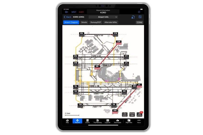
Garmin has added new visual features to its SmartCharts dynamic aviation charting solution in the Garmin Pilot app. A Graphical Notice to Air Missions (NOTAMs) overlay now allows pilots to view active and conditional runway, taxiway and ramp closures directly on airport diagrams. Field condition (FICON) codes are also included on the runway labels, giving pilots a quick reference to surface conditions.
The overlay uses a colour-coded system: closed areas appear in red with yellow Xs marking closed runways, while conditional closures are shown in yellow. If a closure is time-based, a clock icon appears on the runway label. FICON codes are colourised based on the lowest reported NOTAM value, or if no value is given, “FICON” is displayed instead.
The latest update also brings a Storm Tops feature to the mobile app, following its recent integration into Garmin Pilot Web. Storm Tops show the vertical intensity of storms, helping pilots assess whether to fly around, through or over adverse weather.
SmartCharts is available through a Garmin Pilot Premium subscription for iOS devices in the United States and the Bahamas.
“Storm Tops will depict the intensity of each storm, assisting pilots in deciding if they should go through, around or even over-top,” says Garmin.