ACE 2026 - September 8th
 The bimonthly news publication for aviation professionals.
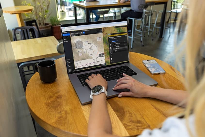
Garmin has added new features to the Garmin Pilot app on Apple mobile devices. New enhancements to the document viewer allow customers to configure folders so they can more easily organise documents such as pilot’s guides and cockpit reference guides, within the app. Additional features include the display of elevation information in the radial menu, night mode on approach charts and the option to print the navigation log.
Documents stored within the document viewer in Garmin Pilot are now synced across all Apple mobile devices running Garmin Pilot. These folders are also customisable by colour and can be reordered for improved organisation of documents such as pilot’s guides, cockpit reference guides, checklists and more.
While flying at night, pilots can now invert the colours on Garmin FliteCharts or Jeppesen terminal approach procedures for enhanced readability during night flights. Pilots have the option to select night mode from the menu in the top right corner when viewing a chart on the map page, in the charts binder, in split-screen view on the synthetic page or while viewing the airport page. Once selected, night mode is consistently displayed throughout the app.
FltPlan.com customers in the US, Canada and the Caribbean that file their flight plan using the FltPlan.com website or Garmin Pilot, now have the option to print their navigation log or the weight and balance sheet from Garmin Pilot. Garmin Pilot Europe subscribers also have the option to print the IFR auto routing briefing packet.
When the terrain database is downloaded, elevation information can be viewed within the inner circle of the radial menu on the map. Pilots can easily view a new logbook report that details the airports they have visited. Each logbook period displays a map with pins to reflect the destination airport, as well as the date, flight time logged and more. The display and animation of lightning has been enhanced on the moving map, and Garmin Pilot also supports the Apple Pencil 2 and a variety of gestures.