


 The bimonthly news publication for aviation professionals.
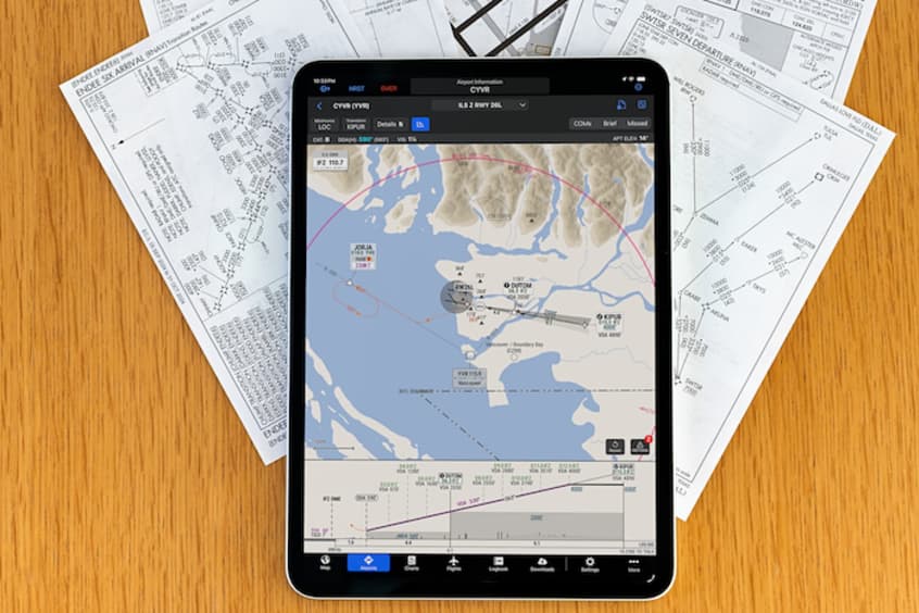
SmartCharts for Garmin Pilot Premium users are now available in Canada and Mexico on both web and Apple mobile platforms. The dynamic aviation charting solution provides pilots a simplified and intuitive experience by producing clear and relevant data to depict a chart tailored for their specific flight operation.
SmartCharts is designed to help optimise pilot workflow by providing only relevant data and reducing workload. Users can make selections like aircraft type, arrival/departure/approach transition fix, runway and more, to simplify the chart down to the information that they need to see to successfully brief and fly that procedure. Starting with standard terminal arrivals (STARs) and standard instrument departures (SIDs), the user selects their aircraft type, the route transition they are flying and the runway of intended use. This reduces depicted information to only show the routing, fixes and crossing restrictions pertinent to their expected procedure. Quick Access buttons also reveal pertinent procedure information like briefing information, communications frequencies, graphical missed approach icons and more so pilots can easily find and decipher information based on the phase of the procedure they are on.
Pilots in Canada and Mexico can now also take advantage of the Continuous Descent Final Approach (CDFA) path shown on the vertical profile view. CDFA allows pilots to descend continuously on a constant path during a non-precision approach, providing a more stable approach and reducing pilot workload. Additionally, cold weather adjustments are available for Canadian and US airports, allowing pilots to operate to cold temperature restricted airports and see the calculations and cold weather corrections within SmartCharts.
Additional improvements in this release include a missed approach climb gradient table being displayed on approach charts and applicable climb gradient values being shown on departure procedure charts.