

ACE 2026 - September 8th
 The bimonthly news publication for aviation professionals.
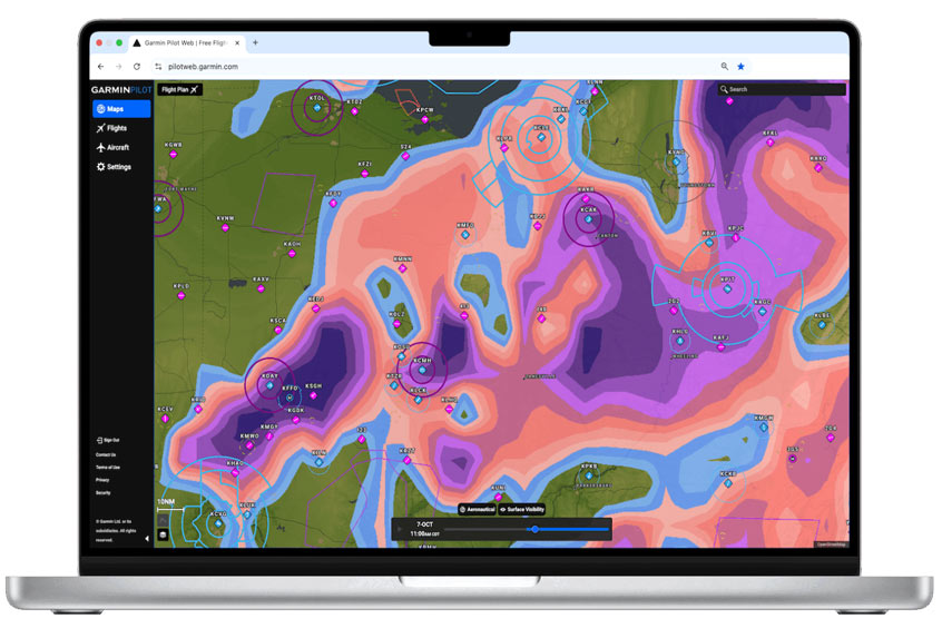
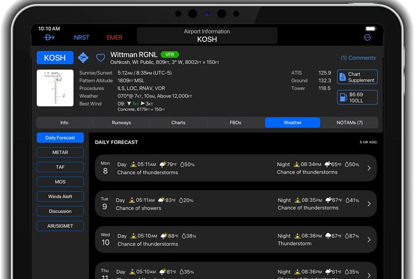
Garmin is launching new weather features on Garmin Pilot Web, its web-centric flight planning platform that complements the Garmin Pilot mobile app. Garmin Pilot Web offers an expansive set of free features for all pilots, including at-a-glance flight planning with high-resolution maps and charts, airport information, aeronautical data and weather overlays for an information-rich experience. With the new weather features, both VFR and instrument pilots can more easily plan routes around challenging weather.
New weather features include: Future Radar – users can now drag the playback bar at the bottom of the screen forward to view future radar and how precipitation and storms may impact their route of flight; Storm Tops – found by clicking the 'Radar' button above the playback bar, the Storm Tops feature will show the tops of storms so pilots can plan flights over or around and discern how powerful a storm system may be; Echo Tops – pilots can now see the altitude of the highest precipitation returns and use this feature to understand storm intensity; Surface Visibility – this forecast feature shows visibility on the surface. Users can drag the playback bar forward to see future visibility; and Freezing Levels – the overlay showcases what altitude the freezing level is at. Pilots can use this feature to potentially find where icing conditions may occur.
Along with the new weather features, users will now be able to take advantage of leg distance and fuel required information when their route is overlaid on the map, making it easy for pilots to plan legs and how much fuel they will need for each leg of their trip.
These features are available now on Garmin Pilot Web. Full-featured flight planning is available in North America at launch, with additional regions planned in the future.